Short hikes - PR ( 'promenade et randonnées')
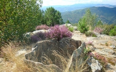
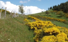
Follow the edge of the Causses and overhang the Gorges du Tarn, discover an ancient farmhouse surrrounded by chestnut trees in Cevennes, enjoy the breathtaking view from the summit of Finiels ... discover the Causses, the Cevennes and the Mont Lozère by foot ... Short hikes vary in distance (in between 5 and 12 km in general) and make you discover the different landscapes of the region..


 Campsites
 Hotel-Restaurants
 Hiker's accommodations
 Bed & Breakfast
 Selfcatering cottages
 Group gîtes
 Quirky accommodations
 Holiday villages